Why everyone should visit the Vail Valley in the fall
Autumn may very well be the most underrated season in the Vail Valley, although that is starting to change. Breathtaking fall foliage marked with golden aspen leaves was once a treat exclusively enjoyed by locals but is now something everyone wants to see. We can’t blame them at all!
The days are still bright and sunny and the temperatures are cooler. The air is crisp and the restaurants, trails, and streets are uncrowded. Visitors are treated to a relaxing stay when rental rates are lower than peak season but there are still plenty of activities for couples, families, and even remote workers to enjoy.
Best time for leaf peeping
Fall colors are at their peak in the mountains earlier than they are in areas at lower elevations. Expect the aspen leaves to start changing colors anywhere from mid September to mid October. The peak season can seem like it is gone in the blink of an eye and usually lasts just 2 weeks. When the colors are at their brightest depends on a number of factors including rainfall, sun, and temperature both throughout the summer and early fall.
Where to stay
Stay in Vail, Beaver Creek, or Edwards. Many hotels will have off-season discounts available and luxury rental properties can be reserved for a fraction of their peak season price.
Browse Properties
HIKES
Aspen Glade
Location: Beaver Creek Mountain
Distance: 0.7 miles if done without connecting trails
Trail Type: out and back
Location: Beaver Creek Mountain
Difficulty: moderate
Elevation Gain: 334 feet
Dogs Allowed?: Yes, on leash.
Highlights: aspen forests and views above Beaver Creek Village
Local Tip: The trail is short but packed with foliage. Connect with Cinch, Village to Village, or Allie’s way trails to create a longer route and a loop.
Trail Map
North Trail
Location: Vail
Distance: 6.7 miles
Trail Type: out and back
Location: Vail
Difficulty: moderate
Elevation Gain: 1,774 feet
Dogs Allowed?: Yes, on leash.
Highlights: Hikers are elevated across the valley from Vail Mountain and gain a unique view looking back towards the slopes. Locals call this the “ski map” view.
Local Tip: This trail has limited parking. We recommend arriving earlier in the morning.
Trail Map
Berrypicker
Location: Vail Mountain
Distance: 7.9 miles
Trail Type: out and back
Location: Vail Mountain
Difficulty: hard
Elevation Gain: 2,286 feet
Dogs Allowed?: Yes, on leash.
Highlights: towering aspen groves and huge views looking down into Vail and Lionshead Villages
Local Tip: Eagle Bahn gondola is open until early October. Hikers can choose to ride the gondola down for free and cut their hiking distance in half.
Trail Map
Booth Falls
Distance: 4.2 miles
Trail Type: out and back
Location: East Vail
Difficulty: moderate-hard
Elevation Gain: 1,358 feet
Dogs Allowed?: Yes, on leash.
Highlights: large waterfall, river crossings, aspen groves, meadows, bighorn sheep
Local Tip: Parts of this trail are very exposed to the sun. Bring sunscreen! Trail parking is limited and this trail is popular. We recommend arriving early in the morning or later in the afternoon.
Trail Map
East Lake Creek
Distance: 2.3 miles to the bridge or up to 23.8 miles to Upper Camp Lake
Trail Type: out and back
Location: Edwards
Difficulty: moderate
Elevation Gain: up to 4,133 feet
Dogs Allowed?: Yes, on leash.
Highlights: aspens, river, wildlife
Local Tip: Most locals turn around at a bridge about 2.3 miles in. This trail is rewarding without making the full trek to Upper Camp Lake.
Trail Map
DRIVES
Jeep Tour
A more unique way to experience fall foliage in the Vail Valley is by taking a Jeep tour. Passengers can relax while their tour guide fills them in on local history and lore. Jeep tours often access more remote or 4×4 roads travelers might not be comfortable taking their own vehicle on.
Independence Pass Loop
This is THE quintessential drive to take in the fall foliage in Colorado. It is a must-see everyone should drive at least once but many take this drive every year. The drive will take 1.5 hours one way without stops. However, there is so much to see along the way that travelers will surely linger and make the trip a minimum of 2 hours one way. We recommend making a full day of the trip and looping through the beautiful town of Aspen. Roads are paved the whole way but there are many tight turns and steep drop offs without guardrails. Anyone can drive this route safely by minding the speed limit and pulling over to admire the views.
Highlights and Stops
- 2 Ghost Towns, Gilman and Independence
- Camp Hale, a now defunct training camp for the 10th Mountain Division ski troops. Last used for mountain and winter warfare training during World War II
- Twin Lakes
- Continental Divide
- Grottos Trail: A great stop off and easy .6 mile loop hiking trail with caves carved from ice hikers can walk through and a waterfall.
Driving directions from Vail – Out and Back
Driving Directions – Loop through Aspen
More Info
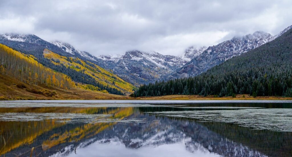
Piney Lake
A scenic drive down a dirt road near Vail which ends at Piney River Ranch and Piney Lake. Turn back at the ranch or park and hike the Upper Piney River trail. Enjoy practically untouched wilderness, aspen groves and views of the Gore Range mountains. Those who complete this drive early in the morning may encounter moose!
Driving Directions